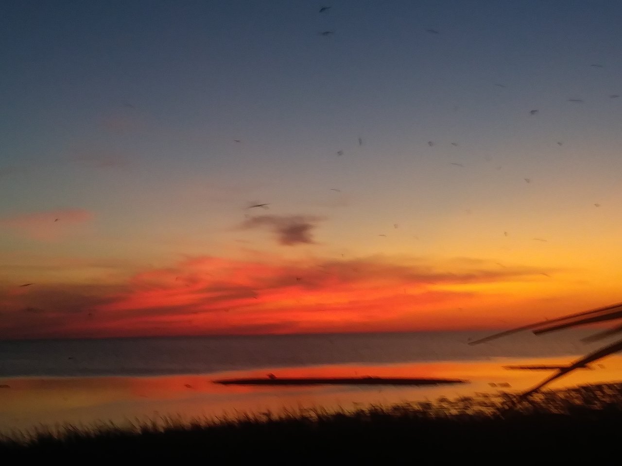
The news anchor was talking about water use restrictions. We were not allowed to water our lawns or wash our cars except on days that corresponded with our home address. The dry season typically begins in January for South Florida and lasts into April, but this year was unusually dry as evidenced by the water restrictions. This came as no surprise to my wife, Loren, and I. We had been hiking in Big Cypress National Preserve the prior weekend and were able to access areas few people are able to see because the ground was dry and the hiking was easy. I had been hiking there several years prior, but was forced to turn back because it was too wet. Given the recent lack of rain we planned our hike for a segment of the Florida Trail contained in Big Cypress National Preserve that I hoped would be dry enough to provide easy access. The weekend arrived and we traveled Interstate 75 about 55 miles west from our home in Fort Lauderdale and were awarded with an amazing opportunity.
The Florida Trail starts at the southern end of Florida in Big Cypress National Preserve about 50 miles west of Miami’s International Airport and travels North to the Suwannee River, then bends West traveling through the Florida Panhandle to end at the Gulf Islands National Seashore near Pensacola. A total of 1,400 miles of trail is now included in a network of primary and spur trails that allow hikers to experience the diversity of Florida from cypress stands in the Everglades to rolling pine forests in North Florida to powdery white sand beaches on the Gulf of Mexico.
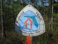
The Florida Trail began as the dream of Jim Kern, a Miami resident who returned to Florida after hiking the Appalachian Trail with a desire to develop a long-distance hiking trail closer to home. Today the trail is marked by a series of orange blazes appearing on trees along the way. These orange blazes first appeared in the Ocala National Forest where the first segment of trail was developed in 1966. Today volunteers from all over the state of Florida help maintain and promote what has been federally designated as a National Scenic Trail. Detailed information about the trail including access points and terrain descriptions are presented on their website: www.floridatrail.org
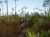
My wife Loren and I left our home in downtown Fort Lauderdale and drove west on Interstate 75 to a rest area at mile marker 63. This rest area provides a convenient place to leave your car, especially if you are planning an extended backpacking trip. Access to the trail is via gates located on either the north or south side of I-75. Identification of these trailheads is made easy with the display of the Florida Trail’s logo on a sign above a trail log. Because of the dry conditions we decided to enter the south gate and hike south into Big Cypress National Preserve. A quick glance on the trail log told me what I already knew; most hikers opted for the trail on the north side of I-75 because the trail on the south side is knee-deep with water for most of the year.
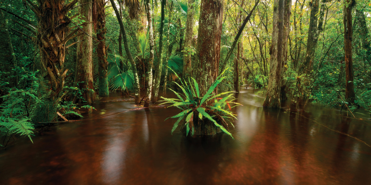
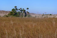
Big Cypress National Preserve abuts Everglades National Park on the park’s northern boundary. The current boundaries of Everglades National Park only contain one fifth of the original area of this ecosystem. The remaining area is now contained in a mix of federal, state and privately owned land. Fresh water flows south from Lake Okeechobee in a giant sheet through the 729,000 acres of the Big Cypress Swamp before entering Everglades National Park enroute to its final destination in the Florida Bay and the Gulf of Mexico. During most of the year Big Cypress lies under a large sheet of water. But during the dry season limited rain does not replenish the constant flow south and earth is revealed. This provides access to the Florida Trail, which travels 45 miles through Big Cypress. As the trail leaves Big Cypress north of I-75, much of the trail is dryer and can be hiked more often during the year because it was built on abandoned roadbeds elevated from the surrounding area. This portion of the tail travels north out of Big Cypress National Preserve and through the Seminole Indian Reservation before continuing on toward Lake Okeechobee.
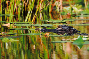
Loren and I arrived in late March after a prolonged dry period. I knew from the watermarks on the cypress trees that it was usually knee-deep along most of this trail. As the water receded a variety of animals had come to drink at the deeper pools. Preserved in the now dry mud was a virtual guest list of animals that had visited the pool. From their tracks one can easily identify deer, raccoons and a variety of wading birds. The trained eye will also see alligator tracks, otter tracks bear tracks and maybe signs of the rare Florida panther. About 3 miles from the gate at I-75 the trail entered a dense stand of cypress trees. Their shade had allowed a few small pools to remain on the trail, and we were startled by a baby alligator that had taken refuge in one. It ducked its head under water in hopes we would not see it as we passed by. We paused for lunch in the cypress stand and then made our way back to the trailhead. On the way back we had the pleasure of seeing a rare everglades mink. Overhead we saw a swallow-tailed kite and several turkey vultures appear to float on breezes that kept us cool while we hiked.
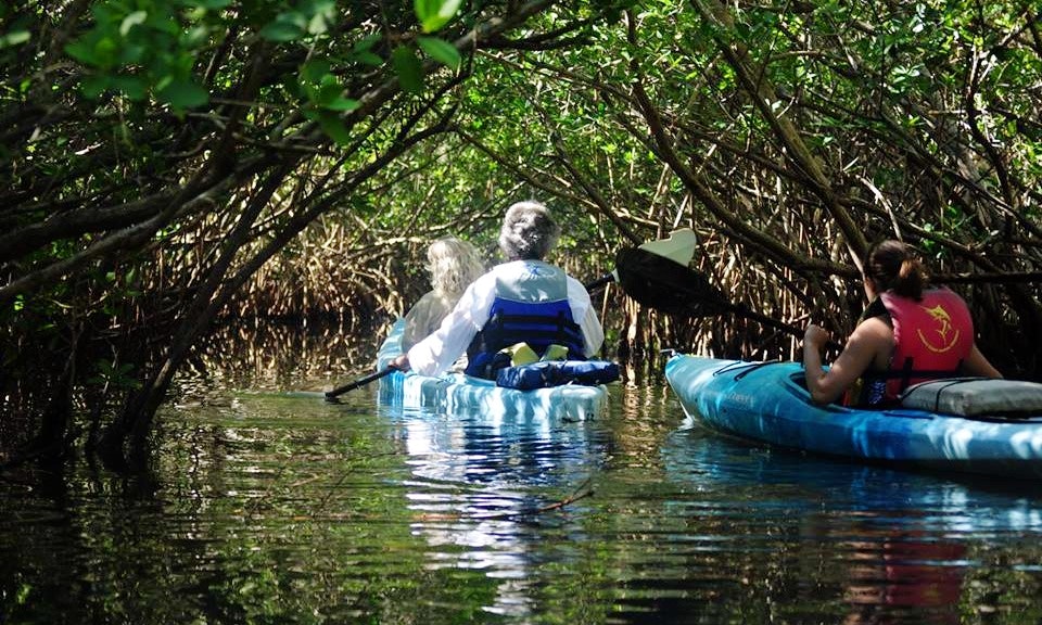
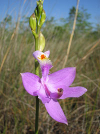
In addition to the signs of animal life we were surrounded by an incredible diversity of plant life. The trail in Big Cypress travels through pine scrub, oak hammocks, cypress stands and grass prairies that look like the African Serengeti. An amazing collection of plants can also be seen including bromeliads, orchids and beautiful wild flowers. Very few people are able to experience this beautiful area because access for most of the year is restricted to travel by either airboat or swamp buggy. During the extremely dry period, however, we were able to easily walk deeper into Big Cypress than I had ever been before and see a wonderful diversity of life.
Get More Information on This Adventure!!!
Experience adventures like the one found in this article and others by using TropicalAdventure.com Vacation Planner. Simply fill out our Vacation Planner form and you will receive FREE information about this activity and others that you may be interested in. Click below to sign up.